In this release, ARCHIBUS has also included an updated version of the ARCHIBUS Geospatial Extensions for Esri. As part of this update, ARCHIBUS has added an Enhanced Map Views feature.
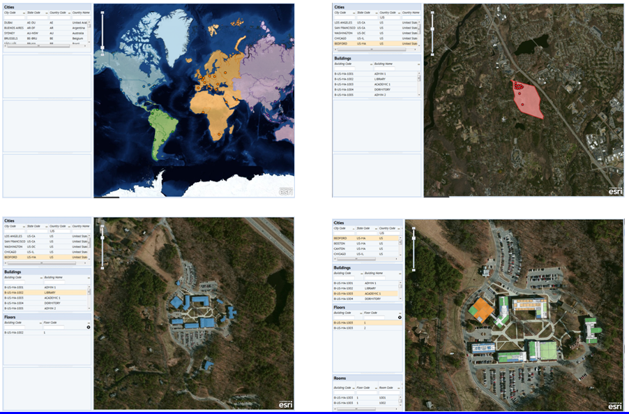
The Enhanced Map Views enable ARCHIBUS customers to visualize their own assets in GIS. Rather than just displaying themed markers and geocoded assets, as the standard Map Views do, the Enhanced Map Views can display parcel, building, suite, room, and other boundaries and extents.
Add-in Managers who have familiarity with GIS and ARCHIBUS configuration can create their own ARCHIBUS Web Central enhanced map views that include customer-specific GIS data. These views can interact with ARCHIBUS panels and controls and can show increasing levels of detail as you zoom into the map. Whether inside or outside a building -- at national, campus, or floor plan scale -- ARCHIBUS allows you to have a single, consistent, common operating picture that can move seamlessly between geographic contexts.
To use the Enhanced Map Views, your site must:
For information, see: http://www.archibus.com/ai/abizfiles/v21.3_help/archibus_help/system/sysman.htm#GIS/intro.htm
| Copyright © 1984-2015, ARCHIBUS, Inc. All rights reserved. |